Images from the Book
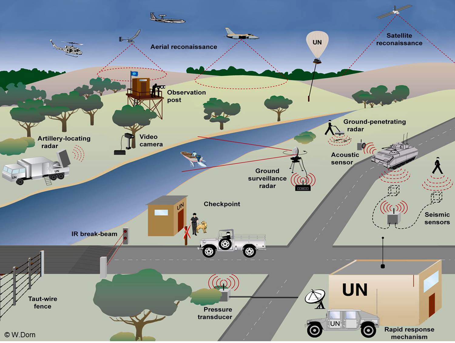
Figure 4.1 Sensors and monitoring platforms for peacekeeping (Figure 4.1) (High-res update here) (© W.Dorn)
OTHER FIGURES FROM KEEPING WATCH (click on number):
2.1 Missions administered by the UN Department of Peacekeeping Operations
2.2 The number of uniformed personnel in UN peacekeeping since 1991
4.1 Composite diagram showing potential sensors and platforms for peacekeeping (figure above) (high res. here)
4.2 The dramatic increase in cell phone usage over one decade in both the developed and the developing world
4.3 Map of incident reports of trapped persons in Port-au-Prince, Haiti, after the January 2010 earthquake
7.1 Locations within Africa of Darfur (Sudan) and the DRC, where the two largest UN missions are operating
7.2 Map showing the Kivu provinces on the eastern border of the DRC and the neighbouring countries
7.3 MI-35 helicopter gunship used in robust peacekeeping
7.4 The pod containing the FLIR camera, attached to a Chilean helicopter in MINUSTAH
7.5 Ground sensor ("Improved REMBASS") system components·
(All images from book © W.Dorn. For permission to use images, please contact Dr. W. Dorn: dorn@rmc.ca)